Geophysical Services
surface and borehole geophysics
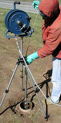 Lowering a borehole video camera into a bedrock monitoring well. 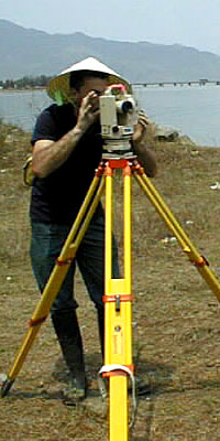 Surface and borehole geophysics.
Our state-of-the-art instrumentation includes:
- (5) Geophysical Survey Systems model SIR-3 & SIR-2000 ground-penetrating radar instruments with 100, 200, 400, 900, and 1,500 megahertz antennas
- ABEM model Terraloc Mark 6 24-channel floating-point seismograph
- (4) Mount Sopris model MGX borehole logging systems, with caliper, heat-pulse flowmeter, fluid temperature, acoustic & optical televiewers, full-waveform sonic, spinner, Idronaut water-quality, and conventional logging probes
- Laval color borehole video camera, with 8mm videocassette recorder
- (2) GeoVisions black & white borehole video cameras
- ABEM model Wadi VLF instrument
- Geometrics model G-856 proton precession magnetometer, and model G-858 cesium-vapor “walking” magnetometer
- (2) Geonics model EM31DL EM-conductivity profiling instruments
- (3) Geonics model EM61 EM metal-locating instruments
- (3) RadioDetection & Metrotech electromagnetic pipe and cable locators
- Pentax 10-second electronic theodolite, with a laser EDM
- AGI Sting/Swift resistivity imaging system, with 63 electrode switches
- ABEM resistivity imaging system, with 84 electrode switches
- 90- & 450-pound accelerated weight-drop seismic source devices
- Hewlett-Packard color inkjet plotter, and computers with extensive software:
- RADAN for Windows, for displaying & processing digital GPR data
- SIPT2 & SeisOpt2D seismic refraction modeling software
- RES2DINV resistivity imaging software
- SURFER and GRAPHER for Windows
- AutoCAD LT for Windows
- WellCad software for borehole geophysical-log plotting
|
